vessel Eagle Sky IMO: 9539298, Wood Chips Carrier
vesseltracker.com
Vessel Eagle Sky IMO: 9539298, Wood Chips Carrier
MMSI: 351010000 callsign: 3FMX3 size: 37x210

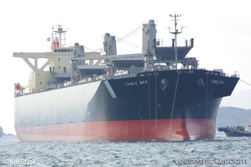
Find the position of the vessel Eagle Sky on the map. The latter are known coordinates and path.

marine traffic ship tracker show on live map

The current position of vessel Eagle Sky is -9.87111 lat / -160.674 lng. Updated: 2024-05-05 02:32:41 UTC
Payload_mass:
63328 tonne
Gross tonnage:
49718
Service entry:
2014-01-01T00:00:00Z
Details:


Last coordinates of the vessel:
UTC, -9.51639, -161.107, course: 125, speed: 10
UTC, -9.71864, -160.861, course: 126, speed: 10.8
UTC, -9.84725, -160.703, course: 125, speed: 10.8
2024-05-05 02:32:41 UTC, -9.87111, -160.674, course: 127, speed: 10.9


Most frequent ports a vessels calls at Eagle Sky (351010000):

Singapore, traffic: 3
Gemalink, traffic: 2
Durban, traffic: 2
Cai Mep, traffic: 2
Imabari, traffic: 2
Portland, traffic: 2
Selat Lombok, traffic: 2
Batangas, traffic: 2
Cape St. Jacques, traffic: 1
Richards Bay, traffic: 1
Sakaide, traffic: 1
Sambu, traffic: 1
Shimotsui, traffic: 1
Bunbury, traffic: 1
Burnie Harbor, traffic: 1

Link to the map:


Find another ship

Eagle_Sky (351010000) last ports (portcalls and passsages)

Shimotsui | 2024-04-15 03:04:33
Imabari | 2024-04-10 22:47:32
Selat Lombok | 2024-03-30 05:30:57
Bunbury | 2024-03-20 05:59:13
Selat Lombok | 2024-03-13 07:13:01
Imabari | 2024-03-02 07:14:14
Vung Tau | 2024-02-16 03:40:12
Cai Mep | 2024-02-15 01:18:50
Cai Mep | 2024-02-11 01:18:18
Gemalink | 2024-02-11 00:02:11
Portland | 2023-04-01 14:02:38
Portland | 2023-03-28 10:59:11
Singapore | 2023-03-12 05:04:13
Burnie Harbor | 2022-08-29 19:18:36
Sambu | 2022-06-07 10:56:40
Durban | 2022-05-18 13:24:50
Durban | 2022-05-14 13:08:34
Richards Bay | 2022-02-25 03:25:59
Singapore | 2022-02-07 08:32:45
Batangas | 2022-02-02 02:05:00