 vesseltracker.com
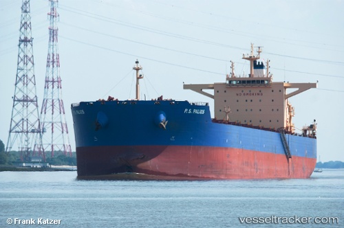
Find the position of the vessel P.s.palios on the map. The latter are known coordinates and path.
marine traffic ship tracker show on live map
The current position of vessel P.s.palios is 38.1384 lat / 121.97 lng. Updated: 2024-05-03 04:52:15 UTCPort of registry:
Majuro (coral atoll, capital of the Marshall Islands)Payload_mass:
179134 tonneGross tonnage:
93166Beam:
45 metreService entry:
2013-01-01T00:00:00ZManufacturer:
Hyundai Heavy Industries (company)
Details:
Last coordinates of the vessel:
UTC, 37.7036, 122.894, course: 301, speed: 12.1UTC, 37.8657, 122.539, course: 299, speed: 11.8
UTC, 38.1219, 122.008, course: 301, speed: 12.2
2024-05-03 04:52:15 UTC, 38.1384, 121.97, course: 298, speed: 12