 vesseltracker.com
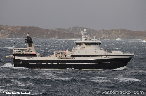
Find the position of the vessel Prestfjord on the map. The latter are known coordinates and path.
marine traffic ship tracker show on live map
The current position of vessel Prestfjord is 76.1182 lat / 36.1757 lng. Updated: 2024-04-29 16:28:15 UTCCurrently sailing under the flag of Norway
Prestfjord built in 2012 year
Deadweight:
1250 tPayload_mass:
1250 tonneGross tonnage:
2610Service entry:
2012-01-01T00:00:00ZManufacturer:
Myklebust VerftDetails:
Last coordinates of the vessel:
UTC, 76.0498, 36.3218, course: 348, speed: 2.4UTC, 76.0615, 36.3187, course: 347, speed: 2.5
UTC, 76.0967, 36.2517, course: -1, speed: 2
2024-04-29 16:28:15 UTC, 76.1182, 36.1757, course: 317, speed: 2.3