 vesseltracker.com
Find the position of the vessel Paula on the map. The latter are known coordinates and path.
marine traffic ship tracker show on live map
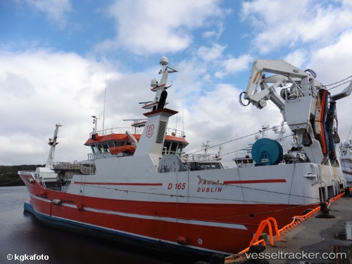
The current position of vessel Paula is 54.6336 lat / -8.44304 lng. Updated: 2024-04-30 06:31:33 UTCCurrently sailing under the flag of Ireland
Paula built in 2011 year
Deadweight:
1700 tPayload_mass:
1700 tonneGross tonnage:
1375Service entry:
2011-01-01T00:00:00ZManufacturer:
Karstensens Skibsværft (danish shipyard)
Details:
Last coordinates of the vessel:
UTC, 54.6336, -8.44312, course: 209, speed: 0UTC, 54.6335, -8.44308, course: 209, speed: 0
UTC, 54.6335, -8.44306, course: 209, speed: 0
2024-04-30 06:31:33 UTC, 54.6336, -8.44304, course: 208, speed: 0