 vesseltracker.com
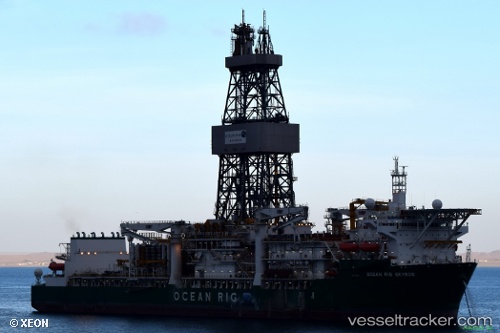
Find the position of the vessel Ocean Rig Skyros on the map. The latter are known coordinates and path.
marine traffic ship tracker show on live map
The current position of vessel Ocean Rig Skyros is -7.17387 lat / 11.1991 lng. Updated: 2024-05-06 01:31:34 UTCCurrently sailing under the flag of Marshall Is
Ocean Rig Skyros built in 2013 year
Port of registry:
Majuro (coral atoll, capital of the Marshall Islands)Deadweight:
60130 tPayload_mass:
60130 tonneGross tonnage:
61279Service entry:
2013-01-01T00:00:00ZManufacturer:
Samsung Heavy Industries (South Korean shipbuilding company)Details:
Last coordinates of the vessel:
UTC, -7.17386, 11.1991, course: 260, speed: 0.3UTC, -7.17386, 11.1991, course: 260, speed: 0.3
UTC, -7.17383, 11.1991, course: 260, speed: 0.1
2024-05-06 01:31:34 UTC, -7.17387, 11.1991, course: 260, speed: 0.6