 vesseltracker.com
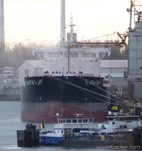
Find the position of the vessel Saita I on the map. The latter are known coordinates and path.
marine traffic ship tracker show on live map
The current position of vessel Saita I is -34.1321 lat / -58.9748 lng. Updated: 2024-05-05 09:07:51 UTCPort of registry:
Limassol (city in the Limassol District, Cyprus)Payload_mass:
81922 tonneGross tonnage:
43007Service entry:
2014-01-01T00:00:00ZManufacturer:
Tsuneishi ShipbuildingDetails:
Last coordinates of the vessel:
UTC, -34.4986, -58.3684, course: 318, speed: 9.1UTC, -34.3773, -58.458, course: 329, speed: 9.1
UTC, -34.2327, -58.7864, course: 299, speed: 10
2024-05-05 09:07:51 UTC, -34.1321, -58.9748, course: 39, speed: 8.3