 vesseltracker.com
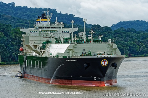
Find the position of the vessel Maria Energy on the map. The latter are known coordinates and path.
marine traffic ship tracker show on live map
The current position of vessel Maria Energy is 19.2698 lat / 107.766 lng. Updated: 2024-05-01 23:44:12 UTCPayload_mass:
93301 tonneGross tonnage:
113664Service entry:
2016-01-01T00:00:00ZManufacturer:
Hyundai Mipo Dockyard (South Korean shipbuilding company)Details:
Last coordinates of the vessel:
UTC, 19.4848, 107.872, course: 50, speed: 14UTC, 19.5874, 108.003, course: 50, speed: 14.6
UTC, 19.428, 107.85, course: 211, speed: 15.8
2024-05-01 23:44:12 UTC, 19.2698, 107.766, course: 214, speed: 15.6