 vesseltracker.com
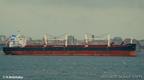
Clear Sky
Current StatusWhere is the vessel?
Clear Sky is currently in Near TEES, based on AIS data received about 1h ago.
Latest AIS update:
Current position: 54.60411° N, 1.15892° W (Near TEES)
Average speed (last 7 days): Loading…
Average speed (last 30 days): Loading…
Vessel profile: Clear Sky is a Bulk Carrier with dimensions 32m x 200m.
This page combines live AIS, route history, probable destination signals, nearby traffic, and port activity for practical vessel monitoring.
The current position of vessel Clear Sky is 54.60411 lat / -1.15892 lng. Updated: 2026-03-25 21:23:58 UTCNearest reference points:
- Near TYNE
- Near Blyth
- Near Hessle/Hull
Details:
Live Vessel Clear Sky Analytics (details, animations, etc.)
Recent AIS points (UTC):
2026-03-25 16:09:16 UTC · 54.60410, -1.15891 · SOG 0 kn · COG 136°2026-03-25 18:01:44 UTC · 54.60413, -1.15894 · SOG 0 kn · COG 136°
2026-03-25 20:16:44 UTC · 54.60410, -1.15888 · SOG 0 kn · COG 136°
2026-03-25 21:23:58 UTC · 54.60411, -1.15892 · SOG 0 kn · COG 136°