 vesseltracker.com
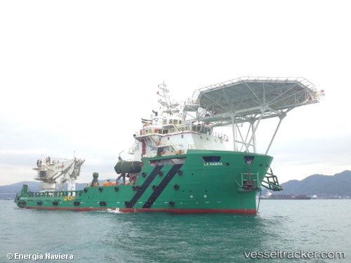
Find the position of the vessel La Bamba on the map. The latter are known coordinates and path.
marine traffic ship tracker show on live map
The current position of vessel La Bamba is 18.7841 lat / -91.8417 lng. Updated: 2024-05-04 12:19:29 UTCCurrently sailing under the flag of Mexico
Port of registry:
Ciudad del Carmen (city of Campeche State, Mexico)Payload_mass:
3109 tonneGross tonnage:
4760Service entry:
2014-01-01T00:00:00ZDetails:
Last coordinates of the vessel:
UTC, 18.784, -91.8418, course: 137, speed: 0.1UTC, 18.7841, -91.8417, course: 95, speed: 0.3
UTC, 18.784, -91.8418, course: 117, speed: 0.1
2024-05-04 12:19:29 UTC, 18.7841, -91.8417, course: 98, speed: 0.2