 vesseltracker.com
Find the position of the vessel 636020675 on the map. The latter are known coordinates and path.
marine traffic ship tracker show on live map
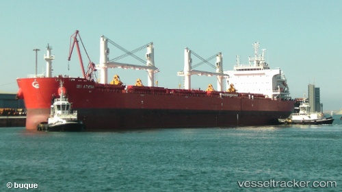
The current position of vessel 636020675 is -8.90829 lat / 66.1141 lng. Updated: 2024-05-02 07:35:32 UTCPort of registry:
Majuro (coral atoll, capital of the Marshall Islands)Payload_mass:
63500 tonneGross tonnage:
36336Service entry:
2015-01-01T00:00:00ZManufacturer:
Chengxi Shipyard (chinese shipyard)Details:
Last coordinates of the vessel:
UTC, -9.46627, 65.5764, course: 44, speed: 10.3UTC, -9.22937, 65.8045, course: 45, speed: 10.4
UTC, -8.94173, 66.0811, course: 47, speed: 10
2024-05-02 07:35:32 UTC, -8.90829, 66.1141, course: 45, speed: 10.3