 vesseltracker.com
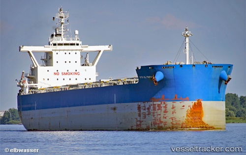
 SERIFOS
Current Status
Where is the vessel?
SERIFOS is currently in Near Newcastle, based on AIS data received about 2h ago.
Latest AIS update:
Current position: 33.00595° S, 151.94209° E (Near Newcastle)
Average speed (last 7 days): Loading…
Average speed (last 30 days): Loading…
Vessel profile: SERIFOS is a Cargo with dimensions m x m.
This page combines live AIS, route history, probable destination signals, nearby traffic, and port activity for practical vessel monitoring.
The current position of vessel SERIFOS is -33.00595 lat / 151.94209 lng. Updated: 2026-03-25 21:58:05 UTCNearest reference points:
- Near Warners Bay
- Near Caves Beach
- Near BILGOLA PLATEAU
Currently sailing under the flag of Marshall Islands ![]()
Details:
Live Vessel SERIFOS Analytics (details, animations, etc.)
Recent AIS points (UTC):
2026-03-25 15:35:24 UTC · -32.99056, 151.84871 · SOG 6.1 kn · COG 146°2026-03-25 18:16:35 UTC · -33.04787, 151.96516 · SOG 1.8 kn · COG 357°
2026-03-25 19:22:14 UTC · -33.06859, 151.95180 · SOG 1.8 kn · COG 231°
2026-03-25 21:58:05 UTC · -33.00595, 151.94209 · SOG 9.2 kn · COG 72°