 vesseltracker.com
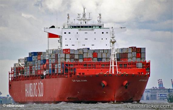
Find the position of the vessel Cap San Juan on the map. The latter are known coordinates and path.
marine traffic ship tracker show on live map
The current position of vessel Cap San Juan is -5.19167 lat / -6.39667 lng. Updated: 2024-05-04 11:27:47 UTCPort of registry:
Majuro (coral atoll, capital of the Marshall Islands)Gross tonnage:
118615Service entry:
2015-01-01T00:00:00ZManufacturer:
Hanwha Ocean (shipbuilder of South Korea)Details:
Last coordinates of the vessel:
UTC, -4.472, -6.88735, course: 144, speed: 16.9UTC, -4.91773, -6.58407, course: 144, speed: 17
UTC, -5.08123, -6.47323, course: 144, speed: 16.9
2024-05-04 11:27:47 UTC, -5.19167, -6.39667, course: -1, speed: 17