 vesseltracker.com
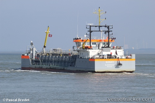
Find the position of the vessel 'MAHURY' on the map. The latter are known coordinates and path.
marine traffic ship tracker show on live map
The current position of vessel 'MAHURY' is 52.5761 lat / 5.489 lng. Updated: 2024-05-19 23:08:25 UTCPort of registry:
Sliedrecht (municipality in the Netherlands)Gross tonnage:
1708Service entry:
2016-01-01T00:00:00ZDetails:
Last coordinates of the vessel:
UTC, 52.5755, 5.48933, course: 212, speed: 2.9UTC, 52.5771, 5.49113, course: 150, speed: 2.7
UTC, 52.573, 5.4855, course: 207, speed: 2.3
2024-05-19 23:08:25 UTC, 52.5761, 5.489, course: 162, speed: 2.2