 vesseltracker.com
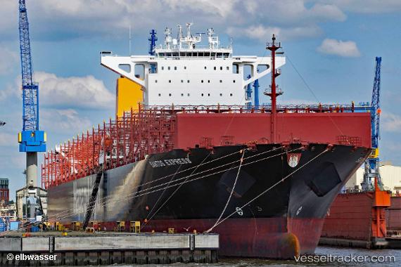
Find the position of the vessel Santos Express on the map. The latter are known coordinates and path.
marine traffic ship tracker show on live map
The current position of vessel Santos Express is 26.6503 lat / -59.6734 lng. Updated: 2024-05-07 08:31:27 UTCPort of registry:
Hamburg (city and state in the North of Germany)Speed:
20 knotPayload_mass:
123490 tonneGross tonnage:
118945Service entry:
2017-01-01T00:00:00ZManufacturer:
Hyundai Samho Heavy Industries (company)Details:
Last coordinates of the vessel:
UTC, 26.0444, -60.3746, course: 44, speed: 19.3UTC, 26.295, -60.0833, course: -1, speed: 19
UTC, 26.5612, -59.7742, course: 44, speed: 19.6
2024-05-07 08:31:27 UTC, 26.6503, -59.6734, course: 45, speed: 19.6