 vesseltracker.com
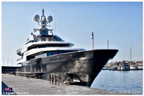
Stellamaris
Current StatusWhere is the vessel?
Stellamaris is currently in Near Rivera Beach, based on AIS data received about 2h ago.
Latest AIS update:
Current position: 26.77096° N, 80.05059° W (Near Rivera Beach)
Average speed (last 7 days): Loading…
Average speed (last 30 days): Loading…
Vessel profile: Stellamaris is a Service Ship with dimensions 13m x 72m.
This page combines live AIS, route history, probable destination signals, nearby traffic, and port activity for practical vessel monitoring.
The current position of vessel Stellamaris is 26.77096 lat / -80.05059 lng. Updated: 2026-03-25 17:48:54 UTCNearest reference points:
- Near Palm Beach
- Near Rivera Beach
- Near Lake Park
Details:
Live Vessel Stellamaris Analytics (details, animations, etc.)
Recent AIS points (UTC):
2026-03-25 11:23:57 UTC · 26.77094, -80.05061 · SOG 0 kn · COG 180°2026-03-25 14:26:51 UTC · 26.77094, -80.05059 · SOG 0 kn · COG 180°
2026-03-25 16:02:54 UTC · 26.77095, -80.05058 · SOG 0 kn · COG 181°
2026-03-25 17:48:54 UTC · 26.77096, -80.05059 · SOG 0 kn · COG 180°