 vesseltracker.com
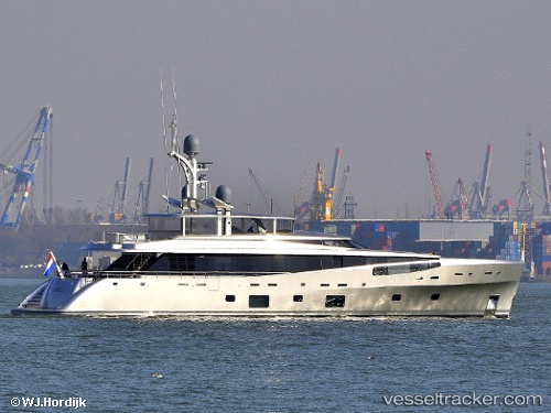
Vessel Lady May IMO: 1012359, MMSI: 319059500 Service Ship
UTC, 26.13875, -80.10894, course: 197, speed: 0
UTC, 26.13875, -80.10893, course: 197, speed: 0
2026-02-21 18:15:12 UTC, 26.13875, -80.10893, course: 197, speed: 0
Live AIS position:
UTC. Near Wilton Manors),
updated 2026-02-21 18:15:12 UTC.
Find the position of the vessel Lady May on the map. The latter are known coordinates and path.
marine traffic ship tracker show on live map
The current position of vessel Lady May is 26.13875 lat / -80.10893 lng. Updated: 2026-02-21 18:15:12 UTCDetails:
Last coordinates of the vessel:
UTC, 26.13875, -80.10894, course: 197, speed: 0UTC, 26.13875, -80.10894, course: 197, speed: 0
UTC, 26.13875, -80.10893, course: 197, speed: 0
2026-02-21 18:15:12 UTC, 26.13875, -80.10893, course: 197, speed: 0