 vesseltracker.com
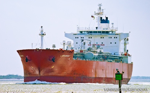
Vessel Libramont IMO: 9292761, MMSI: 205460000 Lpg Tanker
UTC, 48.10331, -126.12256, course: 249, speed: 10.6
UTC, 47.97666, -126.56854, course: 243, speed: 10.7
2026-03-24 10:25:46 UTC, 47.77500, -127.22500, course: -1, speed: 10
Live Vessel Libramont Analytics (details, animations, etc.)
Live AIS position: UTC. 97 nm SW of UCLUELET), updated 2026-03-24 10:25:46 UTC.Find the position of the vessel Libramont on the map. The latter are known coordinates and path.
marine traffic ship tracker show on live map
The current position of vessel Libramont is 47.77500 lat / -127.22500 lng. Updated: 2026-03-24 10:25:46 UTCDetails:
Last coordinates of the vessel:
UTC, 48.26316, -125.58083, course: 251, speed: 10.4UTC, 48.10331, -126.12256, course: 249, speed: 10.6
UTC, 47.97666, -126.56854, course: 243, speed: 10.7
2026-03-24 10:25:46 UTC, 47.77500, -127.22500, course: -1, speed: 10