 vesseltracker.com
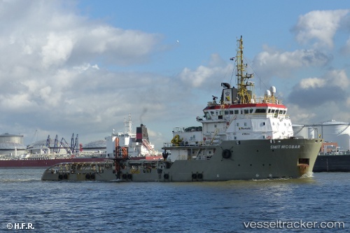
Vessel NICOBAR IMO: 9322592, MMSI: 205684000 Offshore Tug/Supply Ship
UTC, 28.14301, -15.42018, course: 181, speed: 0
UTC, 28.14297, -15.42014, course: 181, speed: 0
2026-03-18 08:16:29 UTC, 28.14305, -15.42023, course: 181, speed: 0
Live Vessel NICOBAR Analytics (details, animations, etc.)
Live AIS position: UTC. Near Las Palmas), updated 2026-03-18 08:16:29 UTC.Find the position of the vessel NICOBAR on the map. The latter are known coordinates and path.
marine traffic ship tracker show on live map
The current position of vessel NICOBAR is 28.14305 lat / -15.42023 lng. Updated: 2026-03-18 08:16:29 UTCCurrently sailing under the flag of Belgium
NICOBAR built in 2006 year
Deadweight:
1930 tDetails:
Last coordinates of the vessel:
UTC, 28.14305, -15.42016, course: 181, speed: 0UTC, 28.14301, -15.42018, course: 181, speed: 0
UTC, 28.14297, -15.42014, course: 181, speed: 0
2026-03-18 08:16:29 UTC, 28.14305, -15.42023, course: 181, speed: 0