 vesseltracker.com
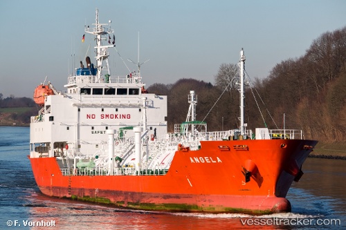
Vessel Angela IMO: 9474541, MMSI: 205772000 Lpg Tanker
UTC, -12.11213, -35.77729, course: 197, speed: 13.4
UTC, -12.55396, -35.92329, course: 199, speed: 13.1
2026-03-22 23:33:54 UTC, -12.88635, -36.04811, course: 198, speed: 13.2
Live Vessel Angela Analytics (details, animations, etc.)
Live AIS position: UTC. 117 nm E of Ibo), updated 2026-03-22 23:33:54 UTC.Find the position of the vessel Angela on the map. The latter are known coordinates and path.
marine traffic ship tracker show on live map
The current position of vessel Angela is -12.88635 lat / -36.04811 lng. Updated: 2026-03-22 23:33:54 UTCCurrently sailing under the flag of Belgium
Angela built in 2009 year
Deadweight:
3996 tDetails:
Last coordinates of the vessel:
UTC, -11.66642, -35.63684, course: 197, speed: 13.1UTC, -12.11213, -35.77729, course: 197, speed: 13.4
UTC, -12.55396, -35.92329, course: 199, speed: 13.1
2026-03-22 23:33:54 UTC, -12.88635, -36.04811, course: 198, speed: 13.2