 vesseltracker.com
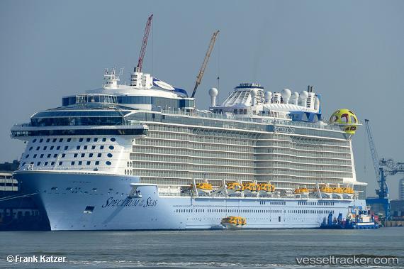
Vessel Spectrum Of The Seas IMO: 9778856, MMSI: 210563000 Cruise Ship
UTC, 34.67353, 135.24483, course: 136, speed: 10.7
UTC, 33.94601, 134.95007, course: 175, speed: 20.7
2026-03-24 09:57:36 UTC, 33.44781, 135.17415, course: 153, speed: 21.2
Live Vessel Spectrum Of The Seas Analytics (details, animations, etc.)
Live AIS position: UTC. 26 nm S of Gobo Wakayama), updated 2026-03-24 09:57:36 UTC.Find the position of the vessel Spectrum Of The Seas on the map. The latter are known coordinates and path.
marine traffic ship tracker show on live map
The current position of vessel Spectrum Of The Seas is 33.44781 lat / 135.17415 lng. Updated: 2026-03-24 09:57:36 UTCCurrently sailing under the flag of Cyprus
Spectrum Of The Seas built in 0 year
Deadweight:
0 tDetails:
Last coordinates of the vessel:
UTC, 34.68009, 135.20361, course: 166, speed: 0UTC, 34.67353, 135.24483, course: 136, speed: 10.7
UTC, 33.94601, 134.95007, course: 175, speed: 20.7
2026-03-24 09:57:36 UTC, 33.44781, 135.17415, course: 153, speed: 21.2