 vesseltracker.com
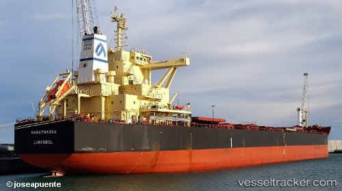
Vessel MARATHASSA IMO: 9698862, MMSI: 210589000 Cargo
UTC, 17.29749, -81.49377, course: 328, speed: 12.1
UTC, 17.58532, -81.72530, course: 328, speed: 12.9
2026-02-27 12:13:05 UTC, 17.99106, -82.04336, course: 326, speed: 12.7
Live AIS position:
UTC. 87 nm SW of Grand Cayman),
updated 2026-02-27 12:13:05 UTC.
Find the position of the vessel MARATHASSA on the map. The latter are known coordinates and path.
marine traffic ship tracker show on live map
The current position of vessel MARATHASSA is 17.99106 lat / -82.04336 lng. Updated: 2026-02-27 12:13:05 UTCDetails:
Last coordinates of the vessel:
UTC, 16.91574, -81.18817, course: 320, speed: 12.1UTC, 17.29749, -81.49377, course: 328, speed: 12.1
UTC, 17.58532, -81.72530, course: 328, speed: 12.9
2026-02-27 12:13:05 UTC, 17.99106, -82.04336, course: 326, speed: 12.7