 vesseltracker.com
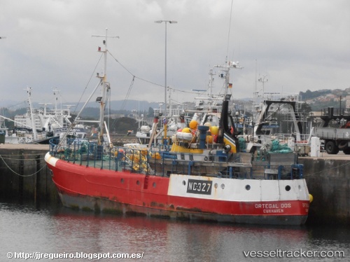
Vessel Ortegal Dos IMO: 7420156, MMSI: 211232850 Fishing Vessel
UTC, 43.35276, -8.38357, course: -1, speed: 0
UTC, 43.35276, -8.38355, course: -1, speed: 0
2026-03-08 00:16:20 UTC, 43.35274, -8.38357, course: -1, speed: 0
Live Vessel Ortegal Dos Analytics (details, animations, etc.)
Live AIS position: UTC. Near CORUNA), updated 2026-03-08 00:16:20 UTC.Find the position of the vessel Ortegal Dos on the map. The latter are known coordinates and path.
marine traffic ship tracker show on live map
The current position of vessel Ortegal Dos is 43.35274 lat / -8.38357 lng. Updated: 2026-03-08 00:16:20 UTCDetails:
Last coordinates of the vessel:
UTC, 43.35275, -8.38356, course: 228, speed: 0UTC, 43.35276, -8.38357, course: -1, speed: 0
UTC, 43.35276, -8.38355, course: -1, speed: 0
2026-03-08 00:16:20 UTC, 43.35274, -8.38357, course: -1, speed: 0