 vesseltracker.com
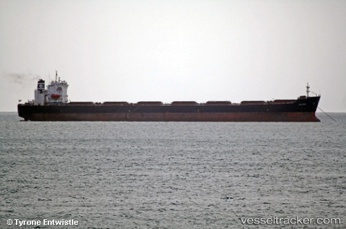
Vessel SEAPOWER I IMO: 9214331, MMSI: 215480000 Bulk Carrier
UTC, 42.0358, 31.8545, course: 250, speed: 10.7
UTC, 42.0358, 31.8545, course: 250, speed: 10.7
2026-02-24 03:44:49 UTC, 42.0358, 31.8545, course: 250, speed: 10.7
Live AIS position:
UTC. 27 nm NW of Bartin),
updated 2026-02-24 03:44:49 UTC.
Find the position of the vessel SEAPOWER I on the map. The latter are known coordinates and path.
marine traffic ship tracker show on live map
The current position of vessel SEAPOWER I is 42.0358 lat / 31.8545 lng. Updated: 2026-02-24 03:44:49 UTCCurrently sailing under the flag of Malta
SEAPOWER I built in 2001 year
Deadweight:
74665 tDetails:
Last coordinates of the vessel:
UTC, 42.1338, 32.236, course: 245, speed: 10.6UTC, 42.0358, 31.8545, course: 250, speed: 10.7
UTC, 42.0358, 31.8545, course: 250, speed: 10.7
2026-02-24 03:44:49 UTC, 42.0358, 31.8545, course: 250, speed: 10.7