 vesseltracker.com
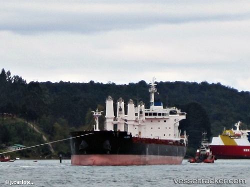
Vessel Alinda IMO: 9588378, MMSI: 215522000 Bulk Carrier
UTC, 38.7597, 26.9228, course: 323, speed: 0
UTC, 38.7597, 26.9228, course: 323, speed: 0
2026-02-12 12:10:26 UTC, 38.7597, 26.9228, course: 320, speed: 0
Live AIS position:
UTC. Near NEMRUT),
updated 2026-02-12 12:10:26 UTC.
Find the position of the vessel Alinda on the map. The latter are known coordinates and path.
marine traffic ship tracker show on live map
The current position of vessel Alinda is 38.7597 lat / 26.9228 lng. Updated: 2026-02-12 12:10:26 UTCCurrently sailing under the flag of Malta
Alinda built in 2012 year
Deadweight:
34035 tDetails:
Last coordinates of the vessel:
UTC, 38.7597, 26.9228, course: 322, speed: 0UTC, 38.7597, 26.9228, course: 323, speed: 0
UTC, 38.7597, 26.9228, course: 323, speed: 0
2026-02-12 12:10:26 UTC, 38.7597, 26.9228, course: 320, speed: 0