 vesseltracker.com
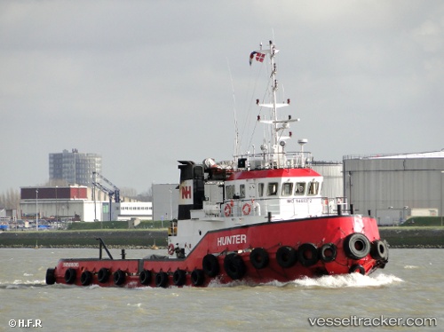
Vessel Hunter IMO: 9468372, MMSI: 219339000 Tug
UTC, 41.28050, -11.18383, course: 8, speed: 5.1
UTC, 41.40773, -11.14175, course: 10, speed: 4.9
2026-02-26 11:33:40 UTC, 41.57424, -11.07558, course: 5, speed: 4.8
Live AIS position:
UTC. 17 nm E of Bear River City),
updated 2026-02-26 11:33:40 UTC.
Find the position of the vessel Hunter on the map. The latter are known coordinates and path.
marine traffic ship tracker show on live map
The current position of vessel Hunter is 41.57424 lat / -11.07558 lng. Updated: 2026-02-26 11:33:40 UTCCurrently sailing under the flag of Denmark
Hunter built in 2008 year
Deadweight:
305 tDetails:
Last coordinates of the vessel:
UTC, 40.97784, -11.28748, course: 11, speed: 5UTC, 41.28050, -11.18383, course: 8, speed: 5.1
UTC, 41.40773, -11.14175, course: 10, speed: 4.9
2026-02-26 11:33:40 UTC, 41.57424, -11.07558, course: 5, speed: 4.8