 vesseltracker.com
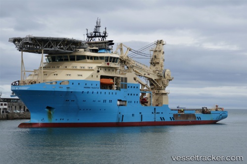
Vessel MAERSK INVENTOR IMO: 9753935, MMSI: 219366000 Offshore Support Vessel
UTC, -15.74151, 116.72207, course: -1, speed: 8.1
UTC, -15.48345, 116.98128, course: 44, speed: 8.1
2026-03-24 14:21:47 UTC, -15.25725, 117.19658, course: 38, speed: 8.2
Live Vessel MAERSK INVENTOR Analytics (details, animations, etc.)
Live AIS position: UTC. 243 nm N of Mutineer), updated 2026-03-24 14:21:47 UTC.Find the position of the vessel MAERSK INVENTOR on the map. The latter are known coordinates and path.
marine traffic ship tracker show on live map
The current position of vessel MAERSK INVENTOR is -15.25725 lat / 117.19658 lng. Updated: 2026-03-24 14:21:47 UTCCurrently sailing under the flag of Denmark (DIS)
MAERSK INVENTOR built in 2018 year
Deadweight:
9734 tDetails:
Last coordinates of the vessel:
UTC, -15.86500, 116.60833, course: -1, speed: 8UTC, -15.74151, 116.72207, course: -1, speed: 8.1
UTC, -15.48345, 116.98128, course: 44, speed: 8.1
2026-03-24 14:21:47 UTC, -15.25725, 117.19658, course: 38, speed: 8.2