 vesseltracker.com
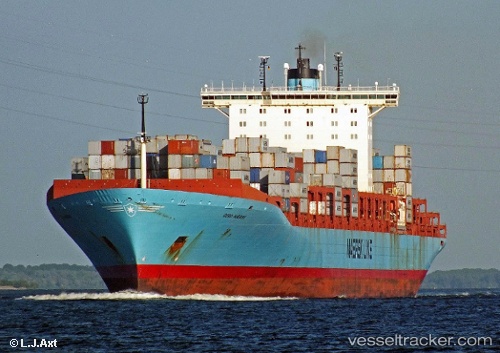
Vessel Gerd Maersk IMO: 9320245, MMSI: 220415000 Container Ship
UTC, 22.56789, 114.27306, course: 320, speed: 0
UTC, 22.56789, 114.27307, course: 320, speed: 0
2026-03-05 06:24:17 UTC, 22.56788, 114.27309, course: 320, speed: 0
Live Vessel Gerd Maersk Analytics (details, animations, etc.)
Live AIS position: UTC. Near Yantian), updated 2026-03-05 06:24:17 UTC.Find the position of the vessel Gerd Maersk on the map. The latter are known coordinates and path.
marine traffic ship tracker show on live map
The current position of vessel Gerd Maersk is 22.56788 lat / 114.27309 lng. Updated: 2026-03-05 06:24:17 UTCCurrently sailing under the flag of Denmark
Gerd Maersk built in 2006 year
Deadweight:
115700 tDetails:
Last coordinates of the vessel:
UTC, 22.56790, 114.27306, course: 319, speed: 0UTC, 22.56789, 114.27306, course: 320, speed: 0
UTC, 22.56789, 114.27307, course: 320, speed: 0
2026-03-05 06:24:17 UTC, 22.56788, 114.27309, course: 320, speed: 0