 vesseltracker.com
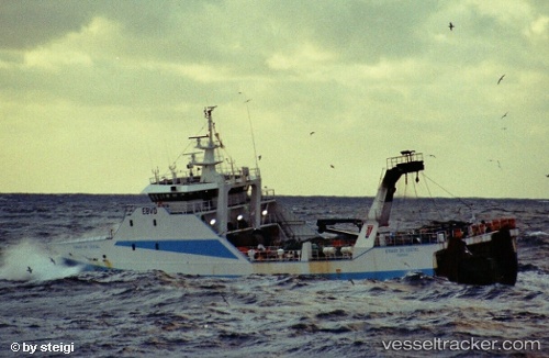
Vessel Eirado Do Costal IMO: 9265328, MMSI: 224430000 Fishing Vessel
UTC, 46.35833, -28.39500, course: -1, speed: 10
UTC, 46.28167, -27.98333, course: -1, speed: 10
2026-01-18 12:32:14 UTC, 46.23333, -27.75667, course: -1, speed: 12
Live AIS position:
UTC. 125 nm NW of Crevedia),
updated 2026-01-18 12:32:14 UTC.
Find the position of the vessel Eirado Do Costal on the map. The latter are known coordinates and path.
marine traffic ship tracker show on live map
The current position of vessel Eirado Do Costal is 46.23333 lat / -27.75667 lng. Updated: 2026-01-18 12:32:14 UTCDetails:
Last coordinates of the vessel:
UTC, 46.42833, -28.77333, course: -1, speed: 11UTC, 46.35833, -28.39500, course: -1, speed: 10
UTC, 46.28167, -27.98333, course: -1, speed: 10
2026-01-18 12:32:14 UTC, 46.23333, -27.75667, course: -1, speed: 12