 vesseltracker.com
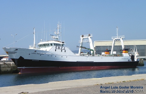
Vessel Manuel Angel Nores IMO: 9281865, MMSI: 224978000 Fishing Vessel
UTC, -34.90160, -56.20719, course: 248, speed: 0
UTC, -34.90161, -56.20719, course: 247, speed: 0
2026-02-14 15:52:55 UTC, -34.90160, -56.20720, course: 247, speed: 0
Live AIS position:
UTC. Near Montevideo),
updated 2026-02-14 15:52:55 UTC.
Find the position of the vessel Manuel Angel Nores on the map. The latter are known coordinates and path.
marine traffic ship tracker show on live map
The current position of vessel Manuel Angel Nores is -34.90160 lat / -56.20720 lng. Updated: 2026-02-14 15:52:55 UTCDetails:
Last coordinates of the vessel:
UTC, -34.90160, -56.20719, course: 249, speed: 0UTC, -34.90160, -56.20719, course: 248, speed: 0
UTC, -34.90161, -56.20719, course: 247, speed: 0
2026-02-14 15:52:55 UTC, -34.90160, -56.20720, course: 247, speed: 0