 vesseltracker.com
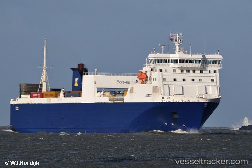
Vessel Norsky IMO: 9186182, MMSI: 230652000 Ro Ro Cargo Ship
UTC, 51.61962, 1.88874, course: 234, speed: 14.1
UTC, 51.49337, 1.09750, course: 276, speed: 14.6
2026-03-14 06:15:35 UTC, 51.45040, 0.38630, course: 16, speed: 2.2
Live Vessel Norsky Analytics (details, animations, etc.)
Live AIS position: UTC. Near Gravesend), updated 2026-03-14 06:15:35 UTC.Find the position of the vessel Norsky on the map. The latter are known coordinates and path.
marine traffic ship tracker show on live map
The current position of vessel Norsky is 51.45040 lat / 0.38630 lng. Updated: 2026-03-14 06:15:35 UTCCurrently sailing under the flag of Finland
Norsky built in 1999 year
Deadweight:
11564 tDetails:
Last coordinates of the vessel:
UTC, 51.92056, 2.58044, course: 235, speed: 13.2UTC, 51.61962, 1.88874, course: 234, speed: 14.1
UTC, 51.49337, 1.09750, course: 276, speed: 14.6
2026-03-14 06:15:35 UTC, 51.45040, 0.38630, course: 16, speed: 2.2