 vesseltracker.com
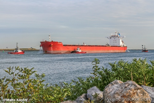
Vessel Cotswold IMO: 9729180, MMSI: 232002969 Lpg Tanker
UTC, -23.34012, 8.36088, course: 322, speed: 11.8
UTC, -23.04108, 8.10899, course: 322, speed: 12
2026-03-24 13:34:28 UTC, -22.73454, 7.85633, course: 323, speed: 11.6
Live Vessel Cotswold Analytics (details, animations, etc.)
Live AIS position: UTC. 359 nm W of Henties Bay (Hentiesbaai)), updated 2026-03-24 13:34:28 UTC.Find the position of the vessel Cotswold on the map. The latter are known coordinates and path.
marine traffic ship tracker show on live map
The current position of vessel Cotswold is -22.73454 lat / 7.85633 lng. Updated: 2026-03-24 13:34:28 UTCDetails:
Last coordinates of the vessel:
UTC, -23.60694, 8.58412, course: 323, speed: 11.9UTC, -23.34012, 8.36088, course: 322, speed: 11.8
UTC, -23.04108, 8.10899, course: 322, speed: 12
2026-03-24 13:34:28 UTC, -22.73454, 7.85633, course: 323, speed: 11.6