 vesseltracker.com
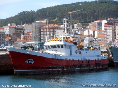
Vessel Tahume IMO: 5128572, MMSI: 232326000 Fishing Vessel
Live Vessel Tahume Analytics (details, animations, etc.)
Live AIS position: UTC. Near SANTA UXIA RIBEIRA), updated 2026-03-12 16:25:37 UTC.Find the position of the vessel Tahume on the map. The latter are known coordinates and path.
marine traffic ship tracker show on live map
The current position of vessel Tahume is 42.55956 lat / -8.98763 lng. Updated: 2026-03-12 16:25:37 UTCDetails:
Last coordinates of the vessel:
2026-03-12 16:25:37 UTC, 42.55956, -8.98763, course: -1, speed: 0