 vesseltracker.com
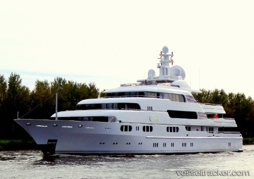
Vessel Titania IMO: 1008695, MMSI: 235081036 Service Ship
UTC, 19.22612, -54.93467, course: 42, speed: 13.1
UTC, 19.60763, -54.54810, course: 45, speed: 12.6
2026-03-24 13:57:40 UTC, 19.93077, -54.21143, course: 43, speed: 12.4
Live Vessel Titania Analytics (details, animations, etc.)
Live AIS position: UTC. 370 nm SE of Luque), updated 2026-03-24 13:57:40 UTC.Find the position of the vessel Titania on the map. The latter are known coordinates and path.
marine traffic ship tracker show on live map
The current position of vessel Titania is 19.93077 lat / -54.21143 lng. Updated: 2026-03-24 13:57:40 UTCCurrently sailing under the flag of United Kingdom
Titania built in 2006 year
Deadweight:
316 tDetails:
Last coordinates of the vessel:
UTC, 18.91360, -55.25178, course: 41, speed: 13.2UTC, 19.22612, -54.93467, course: 42, speed: 13.1
UTC, 19.60763, -54.54810, course: 45, speed: 12.6
2026-03-24 13:57:40 UTC, 19.93077, -54.21143, course: 43, speed: 12.4