 vesseltracker.com
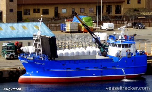
Vessel Havilah IMO: 9193771, MMSI: 235106049 Fish Carrier
UTC, 54.60979, -5.91455, course: 220, speed: 0
UTC, 54.60981, -5.91451, course: 220, speed: 0.1
2026-03-01 15:55:33 UTC, 54.60981, -5.91449, course: 220, speed: 0.1
Live AIS position:
UTC. Near Belfast),
updated 2026-03-01 15:55:33 UTC.
Find the position of the vessel Havilah on the map. The latter are known coordinates and path.
marine traffic ship tracker show on live map
The current position of vessel Havilah is 54.60981 lat / -5.91449 lng. Updated: 2026-03-01 15:55:33 UTCCurrently sailing under the flag of United Kingdom
Havilah built in 1999 year
Details:
Last coordinates of the vessel:
UTC, 54.60986, -5.91448, course: 221, speed: 0.1UTC, 54.60979, -5.91455, course: 220, speed: 0
UTC, 54.60981, -5.91451, course: 220, speed: 0.1
2026-03-01 15:55:33 UTC, 54.60981, -5.91449, course: 220, speed: 0.1