 vesseltracker.com
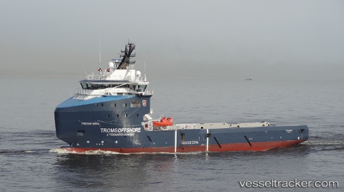
Vessel Troms Mira IMO: 9709116, MMSI: 235108602 Offshore Supply Ship
UTC, 57.14333, -2.09167, course: -1, speed: 0
UTC, 57.14485, -2.09307, course: 57, speed: 0
2026-03-24 15:41:20 UTC, 57.14487, -2.09312, course: 57, speed: 0
Live Vessel Troms Mira Analytics (details, animations, etc.)
Live AIS position: UTC. Near Aberdeen), updated 2026-03-24 15:41:20 UTC.Find the position of the vessel Troms Mira on the map. The latter are known coordinates and path.
marine traffic ship tracker show on live map
The current position of vessel Troms Mira is 57.14487 lat / -2.09312 lng. Updated: 2026-03-24 15:41:20 UTCDetails:
Last coordinates of the vessel:
UTC, 57.14488, -2.09310, course: 57, speed: 0UTC, 57.14333, -2.09167, course: -1, speed: 0
UTC, 57.14485, -2.09307, course: 57, speed: 0
2026-03-24 15:41:20 UTC, 57.14487, -2.09312, course: 57, speed: 0