 vesseltracker.com
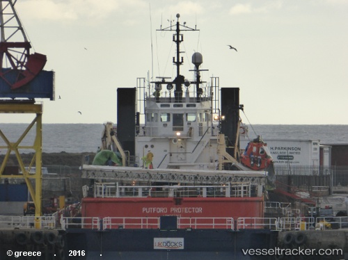
Vessel Putford Protector IMO: 8119235, MMSI: 235453000 Offshore Tug Supply Ship
UTC, 58.26044, 6.84132, course: -1, speed: 0
UTC, 58.26044, 6.84132, course: -1, speed: 0
2026-02-12 14:05:59 UTC, 58.26044, 6.84132, course: -1, speed: 0
Live AIS position:
UTC. Near Abelnes),
updated 2026-02-12 14:05:59 UTC.
Find the position of the vessel Putford Protector on the map. The latter are known coordinates and path.
marine traffic ship tracker show on live map
The current position of vessel Putford Protector is 58.26044 lat / 6.84132 lng. Updated: 2026-02-12 14:05:59 UTCCurrently sailing under the flag of United Kingdom
Putford Protector built in 1983 year
Deadweight:
2036 tDetails:
Last coordinates of the vessel:
UTC, 58.26044, 6.84132, course: -1, speed: 0UTC, 58.26044, 6.84132, course: -1, speed: 0
UTC, 58.26044, 6.84132, course: -1, speed: 0
2026-02-12 14:05:59 UTC, 58.26044, 6.84132, course: -1, speed: 0