 vesseltracker.com
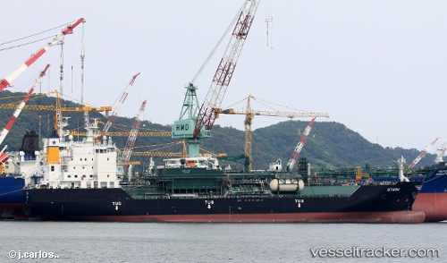
Vessel Othoni IMO: 9711494, MMSI: 241389000 Lpg Tanker
UTC, 35.53138, -4.11142, course: 221, speed: 2.8
UTC, 35.62738, -4.17116, course: 324, speed: 6.9
2026-02-10 21:36:45 UTC, 35.74651, -4.34651, course: 296, speed: 6.7
Live AIS position:
UTC. 37 nm NW of Al Hoceima),
updated 2026-02-10 21:36:45 UTC.
Find the position of the vessel Othoni on the map. The latter are known coordinates and path.
marine traffic ship tracker show on live map
The current position of vessel Othoni is 35.74651 lat / -4.34651 lng. Updated: 2026-02-10 21:36:45 UTCDetails:
Last coordinates of the vessel:
UTC, 35.64932, -4.13238, course: 215, speed: 3.1UTC, 35.53138, -4.11142, course: 221, speed: 2.8
UTC, 35.62738, -4.17116, course: 324, speed: 6.9
2026-02-10 21:36:45 UTC, 35.74651, -4.34651, course: 296, speed: 6.7