 vesseltracker.com
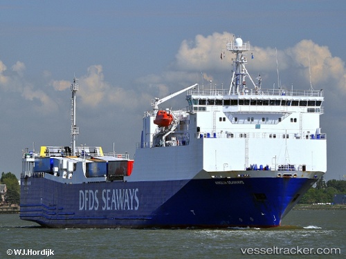
Vessel Blue Carrier 1 IMO: 9186649, MMSI: 241671000 Ro Ro Cargo Ship
UTC, 36.44422, 28.23668, course: 0, speed: 0
UTC, 36.44428, 28.23670, course: 0, speed: 0
2026-02-01 14:34:16 UTC, 36.44421, 28.23663, course: 359, speed: 0
Live AIS position:
UTC. Near Rhodes),
updated 2026-02-01 14:34:16 UTC.
Find the position of the vessel Blue Carrier 1 on the map. The latter are known coordinates and path.
marine traffic ship tracker show on live map
The current position of vessel Blue Carrier 1 is 36.44421 lat / 28.23663 lng. Updated: 2026-02-01 14:34:16 UTCCurrently sailing under the flag of Greece
Blue Carrier 1 built in 2000 year
Deadweight:
4650 tDetails:
Last coordinates of the vessel:
UTC, 36.47774, 28.10644, course: 98, speed: 15.5UTC, 36.44422, 28.23668, course: 0, speed: 0
UTC, 36.44428, 28.23670, course: 0, speed: 0
2026-02-01 14:34:16 UTC, 36.44421, 28.23663, course: 359, speed: 0