 vesseltracker.com
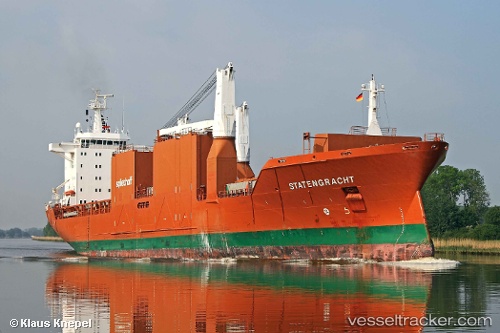
Vessel Statengracht IMO: 9288045, MMSI: 244584000 Multi Purpose Carrier
UTC, 54.98303, 7.38963, course: 355, speed: 15.7
UTC, 55.55055, 7.32522, course: -1, speed: 15.1
2026-02-27 05:23:06 UTC, 56.02883, 7.32297, course: 1, speed: 15.6
Live AIS position:
UTC. 27 nm W of HVIDE SANDE),
updated 2026-02-27 05:23:06 UTC.
Find the position of the vessel Statengracht on the map. The latter are known coordinates and path.
marine traffic ship tracker show on live map
The current position of vessel Statengracht is 56.02883 lat / 7.32297 lng. Updated: 2026-02-27 05:23:06 UTCCurrently sailing under the flag of Netherlands
Statengracht built in 2004 year
Deadweight:
21250 tDetails:
Last coordinates of the vessel:
UTC, 54.58243, 7.42780, course: -1, speed: 15.7UTC, 54.98303, 7.38963, course: 355, speed: 15.7
UTC, 55.55055, 7.32522, course: -1, speed: 15.1
2026-02-27 05:23:06 UTC, 56.02883, 7.32297, course: 1, speed: 15.6