 vesseltracker.com
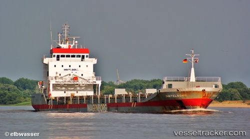
Vessel Dintelborg IMO: 9163685, MMSI: 245279000 General Cargo Ship
UTC, 59.11779, 9.62020, course: 122, speed: 0
UTC, 59.11779, 9.62016, course: 121, speed: 0
2026-03-24 13:34:55 UTC, 59.11782, 9.62023, course: 122, speed: 0
Live Vessel Dintelborg Analytics (details, animations, etc.)
Live AIS position: UTC. Near Herøya), updated 2026-03-24 13:34:55 UTC.Find the position of the vessel Dintelborg on the map. The latter are known coordinates and path.
marine traffic ship tracker show on live map
The current position of vessel Dintelborg is 59.11782 lat / 9.62023 lng. Updated: 2026-03-24 13:34:55 UTCCurrently sailing under the flag of Netherlands
Dintelborg built in 1999 year
Deadweight:
8865 tDetails:
Last coordinates of the vessel:
UTC, 59.11783, 9.62021, course: 122, speed: 0UTC, 59.11779, 9.62020, course: 122, speed: 0
UTC, 59.11779, 9.62016, course: 121, speed: 0
2026-03-24 13:34:55 UTC, 59.11782, 9.62023, course: 122, speed: 0