 vesseltracker.com
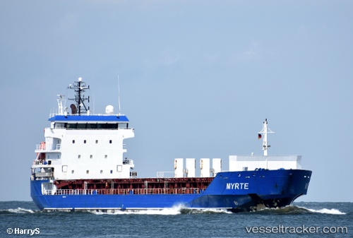
Vessel Myrte IMO: 9364136, MMSI: 246110000 Multi Purpose Carrier
UTC, 60.42733, 26.91917, course: 131, speed: 0.9
UTC, 60.26683, 26.48243, course: 234, speed: 8.7
2026-03-24 23:30:30 UTC, 60.05177, 26.07613, course: 223, speed: 11.4
Live Vessel Myrte Analytics (details, animations, etc.)
Live AIS position: UTC. 17 nm SE of Vessölandet), updated 2026-03-24 23:30:30 UTC.Find the position of the vessel Myrte on the map. The latter are known coordinates and path.
marine traffic ship tracker show on live map
The current position of vessel Myrte is 60.05177 lat / 26.07613 lng. Updated: 2026-03-24 23:30:30 UTCCurrently sailing under the flag of Netherlands
Myrte built in 2008 year
Deadweight:
7124 tDetails:
Last coordinates of the vessel:
UTC, 60.42734, 26.91913, course: 131, speed: 0.1UTC, 60.42733, 26.91917, course: 131, speed: 0.9
UTC, 60.26683, 26.48243, course: 234, speed: 8.7
2026-03-24 23:30:30 UTC, 60.05177, 26.07613, course: 223, speed: 11.4