 vesseltracker.com
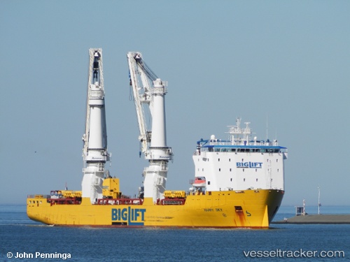
Vessel Happy Sky IMO: 9457220, MMSI: 246714000 Heavy Load Carrier
UTC, 31.09241, 122.55298, course: 92, speed: 13.5
UTC, 31.09102, 123.00766, course: 90, speed: 13
2026-02-13 09:56:52 UTC, 31.07813, 123.48415, course: 97, speed: 12.7
Live AIS position:
UTC. 47 nm E of Lü-hua Shan),
updated 2026-02-13 09:56:52 UTC.
Find the position of the vessel Happy Sky on the map. The latter are known coordinates and path.
marine traffic ship tracker show on live map
The current position of vessel Happy Sky is 31.07813 lat / 123.48415 lng. Updated: 2026-02-13 09:56:52 UTCCurrently sailing under the flag of Netherlands
Happy Sky built in 2013 year
Deadweight:
18680 tDetails:
Last coordinates of the vessel:
UTC, 31.20449, 122.13432, course: 132, speed: 13UTC, 31.09241, 122.55298, course: 92, speed: 13.5
UTC, 31.09102, 123.00766, course: 90, speed: 13
2026-02-13 09:56:52 UTC, 31.07813, 123.48415, course: 97, speed: 12.7