 vesseltracker.com
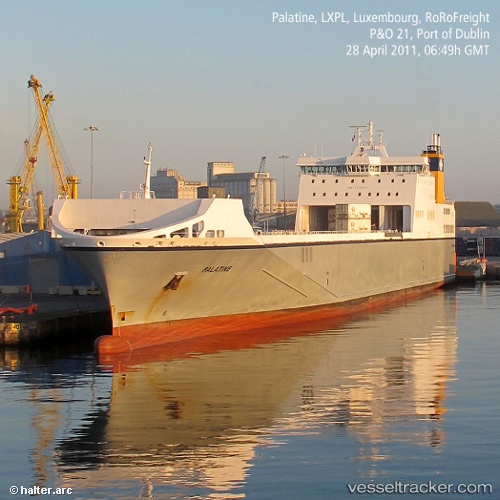
Vessel Palatine IMO: 9376701, MMSI: 248064000 Ro Ro Cargo Ship
UTC, 51.83633, 2.56130, course: 91, speed: 11.2
UTC, 51.84860, 3.07284, course: 78, speed: 11.3
2026-02-22 04:25:54 UTC, 51.97238, 3.79386, course: 84, speed: 11.9
Live AIS position:
UTC. Near Llanwrda),
updated 2026-02-22 04:25:54 UTC.
Find the position of the vessel Palatine on the map. The latter are known coordinates and path.
marine traffic ship tracker show on live map
The current position of vessel Palatine is 51.97238 lat / 3.79386 lng. Updated: 2026-02-22 04:25:54 UTCCurrently sailing under the flag of Malta
Palatine built in 2009 year
Deadweight:
14565 tDetails:
Last coordinates of the vessel:
UTC, 51.68525, 2.08394, course: 48, speed: 11.3UTC, 51.83633, 2.56130, course: 91, speed: 11.2
UTC, 51.84860, 3.07284, course: 78, speed: 11.3
2026-02-22 04:25:54 UTC, 51.97238, 3.79386, course: 84, speed: 11.9