 vesseltracker.com
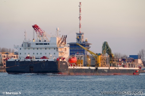
Vessel Ulisse IMO: 8688535, MMSI: 249651000 General Cargo Ship
UTC, 36.86377, -76.31547, course: 223, speed: 38.3
UTC, 36.86377, -76.31547, course: 223, speed: 38.3
2026-01-31 13:22:33 UTC, 36.86377, -76.31547, course: 223, speed: 38.3
Live AIS position:
UTC. Near Norfolk),
updated 2026-01-31 13:22:33 UTC.
Find the position of the vessel Ulisse on the map. The latter are known coordinates and path.
marine traffic ship tracker show on live map
The current position of vessel Ulisse is 36.86377 lat / -76.31547 lng. Updated: 2026-01-31 13:22:33 UTCDetails:
Last coordinates of the vessel:
UTC, 36.86377, -76.31547, course: 223, speed: 38.3UTC, 36.86377, -76.31547, course: 223, speed: 38.3
UTC, 36.86377, -76.31547, course: 223, speed: 38.3
2026-01-31 13:22:33 UTC, 36.86377, -76.31547, course: 223, speed: 38.3