 vesseltracker.com
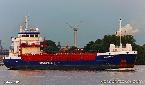
Vessel NOORDVLIET IMO: 9518220, MMSI: 255805568 General Cargo Ship
UTC, 40.64414, -8.72232, course: 334, speed: 0
UTC, 40.64416, -8.72240, course: 333, speed: 0.1
2026-01-31 11:41:25 UTC, 40.64410, -8.72230, course: 333, speed: 0
Live AIS position:
UTC. Near Gafanha da Nazaré),
updated 2026-01-31 11:41:25 UTC.
Find the position of the vessel NOORDVLIET on the map. The latter are known coordinates and path.
marine traffic ship tracker show on live map
The current position of vessel NOORDVLIET is 40.64410 lat / -8.72230 lng. Updated: 2026-01-31 11:41:25 UTCCurrently sailing under the flag of Portugal (MAR)
NOORDVLIET built in 2013 year
Deadweight:
3850 tDetails:
Last coordinates of the vessel:
UTC, 40.64411, -8.72232, course: 333, speed: 0UTC, 40.64414, -8.72232, course: 334, speed: 0
UTC, 40.64416, -8.72240, course: 333, speed: 0.1
2026-01-31 11:41:25 UTC, 40.64410, -8.72230, course: 333, speed: 0