 vesseltracker.com
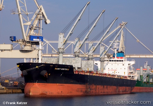
Vessel SAINT DIMITRIOS IMO: 9486398, MMSI: 255915966 Bulk Carrier
UTC, 57.58570, 11.67646, course: 303, speed: 0
UTC, 57.58502, 11.67594, course: 312, speed: 0.2
2026-03-01 17:35:43 UTC, 57.58493, 11.67459, course: 316, speed: 0
Live AIS position:
UTC. Near Sandvik, Styrsö),
updated 2026-03-01 17:35:43 UTC.
Find the position of the vessel SAINT DIMITRIOS on the map. The latter are known coordinates and path.
marine traffic ship tracker show on live map
The current position of vessel SAINT DIMITRIOS is 57.58493 lat / 11.67459 lng. Updated: 2026-03-01 17:35:43 UTCCurrently sailing under the flag of Portugal
Details:
Last coordinates of the vessel:
UTC, 57.58704, 11.67703, course: -1, speed: 0.1UTC, 57.58570, 11.67646, course: 303, speed: 0
UTC, 57.58502, 11.67594, course: 312, speed: 0.2
2026-03-01 17:35:43 UTC, 57.58493, 11.67459, course: 316, speed: 0