 vesseltracker.com
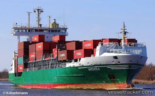
Vessel ANDREA IMO: 9333357, MMSI: 255993000 Container Ship
UTC, 36.83221, -2.47368, course: 132, speed: 0
UTC, 36.83229, -2.47369, course: 132, speed: 0
2026-03-24 07:47:30 UTC, 36.83229, -2.47369, course: 132, speed: 0
Live Vessel ANDREA Analytics (details, animations, etc.)
Live AIS position: UTC. Near Almeria), updated 2026-03-24 07:47:30 UTC.Find the position of the vessel ANDREA on the map. The latter are known coordinates and path.
marine traffic ship tracker show on live map
The current position of vessel ANDREA is 36.83229 lat / -2.47369 lng. Updated: 2026-03-24 07:47:30 UTCCurrently sailing under the flag of Portugal
Details:
Last coordinates of the vessel:
UTC, 36.83226, -2.47368, course: 132, speed: 0UTC, 36.83221, -2.47368, course: 132, speed: 0
UTC, 36.83229, -2.47369, course: 132, speed: 0
2026-03-24 07:47:30 UTC, 36.83229, -2.47369, course: 132, speed: 0