 vesseltracker.com
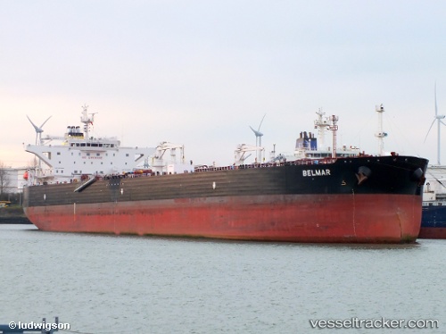
Vessel Belmar IMO: 9516959, MMSI: 256377000 Crude Oil Tanker
UTC, 13.79074, 50.84788, course: 258, speed: 9
UTC, 13.75695, 50.73868, course: 258, speed: 8.9
2026-02-28 20:22:14 UTC, 13.57710, 50.16444, course: 265, speed: 8.9
Live AIS position:
UTC. 56 nm SW of Reinhardtsdorf-Schöna),
updated 2026-02-28 20:22:14 UTC.
Find the position of the vessel Belmar on the map. The latter are known coordinates and path.
marine traffic ship tracker show on live map
The current position of vessel Belmar is 13.57710 lat / 50.16444 lng. Updated: 2026-02-28 20:22:14 UTCCurrently sailing under the flag of Malta
Belmar built in 2011 year
Deadweight:
115903 tDetails:
Last coordinates of the vessel:
UTC, 13.90635, 51.23064, course: 259, speed: 9UTC, 13.79074, 50.84788, course: 258, speed: 9
UTC, 13.75695, 50.73868, course: 258, speed: 8.9
2026-02-28 20:22:14 UTC, 13.57710, 50.16444, course: 265, speed: 8.9