 vesseltracker.com
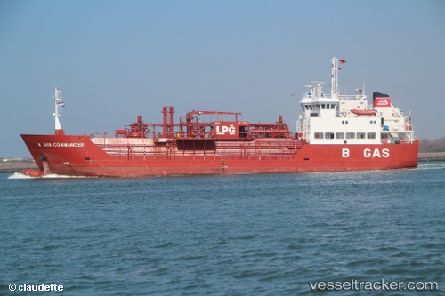
 B Gas Commander
Current Status
Where is the vessel?
B Gas Commander is currently in 131 nm NE of Velke Bierovce, based on AIS data received about 4h ago.
Latest AIS update:
Current position: 49.86826° N, 179.47159° E (131 nm NE of Velke Bierovce)
Average speed (last 7 days): Loading…
Average speed (last 30 days): Loading…
Vessel profile: B Gas Commander is a Lpg Tanker with dimensions 74m x 74m.
This page combines live AIS, route history, probable destination signals, nearby traffic, and port activity for practical vessel monitoring.
The current position of vessel B Gas Commander is 49.86826 lat / 179.47159 lng. Updated: 2026-03-25 06:06:49 UTCCurrently sailing under the flag of Malta ![]()
B Gas Commander built in 1996 year
Deadweight:
2335 tDetails:
Live Vessel B Gas Commander Analytics (details, animations, etc.)
Recent AIS points (UTC):
2026-03-24 23:44:34 UTC · 49.54500, 177.80333 · SOG 10 kn · COG -1°2026-03-25 01:45:17 UTC · 49.66372, 178.34042 · SOG 11.2 kn · COG 72°
2026-03-25 03:29:26 UTC · 49.74809, 178.80388 · SOG 10.5 kn · COG 74°
2026-03-25 06:06:49 UTC · 49.86826, 179.47159 · SOG 9.8 kn · COG 75°