 vesseltracker.com
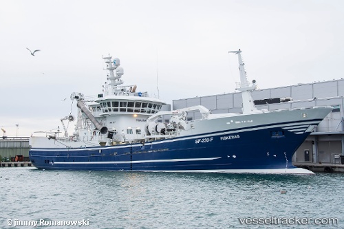
Vessel Fiskebas IMO: 9646998, MMSI: 257135000 Fish Carrier
UTC, 61.60314, 5.04454, course: 92, speed: 0
UTC, 61.60167, 5.04333, course: -1, speed: 0
2026-02-27 13:56:47 UTC, 61.60167, 5.04333, course: -1, speed: 0
Live AIS position:
UTC. Near Flora),
updated 2026-02-27 13:56:47 UTC.
Find the position of the vessel Fiskebas on the map. The latter are known coordinates and path.
marine traffic ship tracker show on live map
The current position of vessel Fiskebas is 61.60167 lat / 5.04333 lng. Updated: 2026-02-27 13:56:47 UTCCurrently sailing under the flag of Norway
Details:
Last coordinates of the vessel:
UTC, 61.60315, 5.04451, course: 92, speed: 0UTC, 61.60314, 5.04454, course: 92, speed: 0
UTC, 61.60167, 5.04333, course: -1, speed: 0
2026-02-27 13:56:47 UTC, 61.60167, 5.04333, course: -1, speed: 0